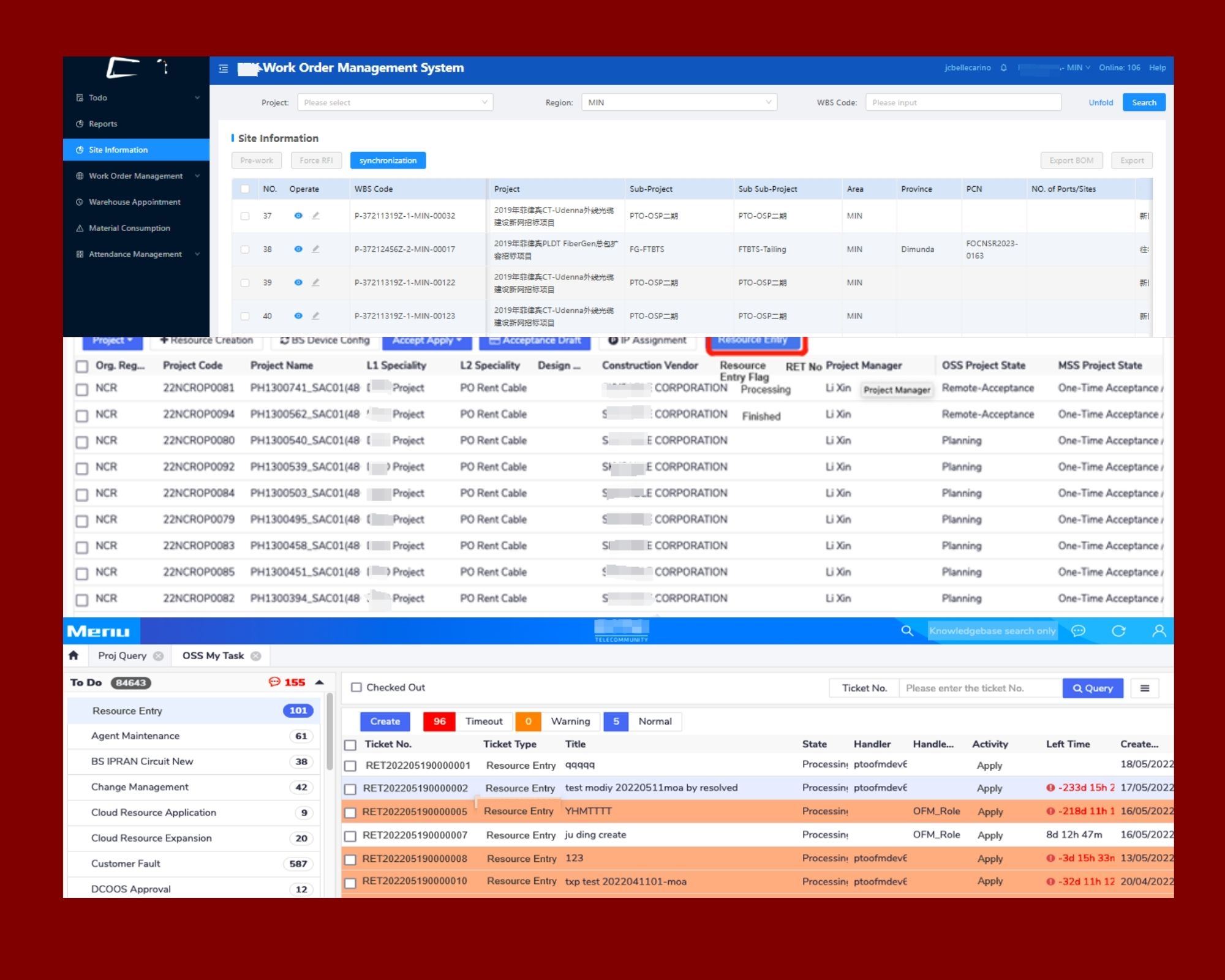
ArcGIS Digitizing Project
As a virtual assistant with GIS skills, I created a detailed digitized map of Deca Homes Talomo in Bago Gallera, Davao City using ArcGIS Pro. This project showcases my ability to visualize residential layouts, infrastructure points, and road networks—ideal for clients needing spatial analysis, planning support, or custom map creation.
Subdivision Planning and Infrastructure Mapping using ArcGIS Pro
Digitized Map of Residential Phases and Infrastructure in Deca Homes Talomo, Davao City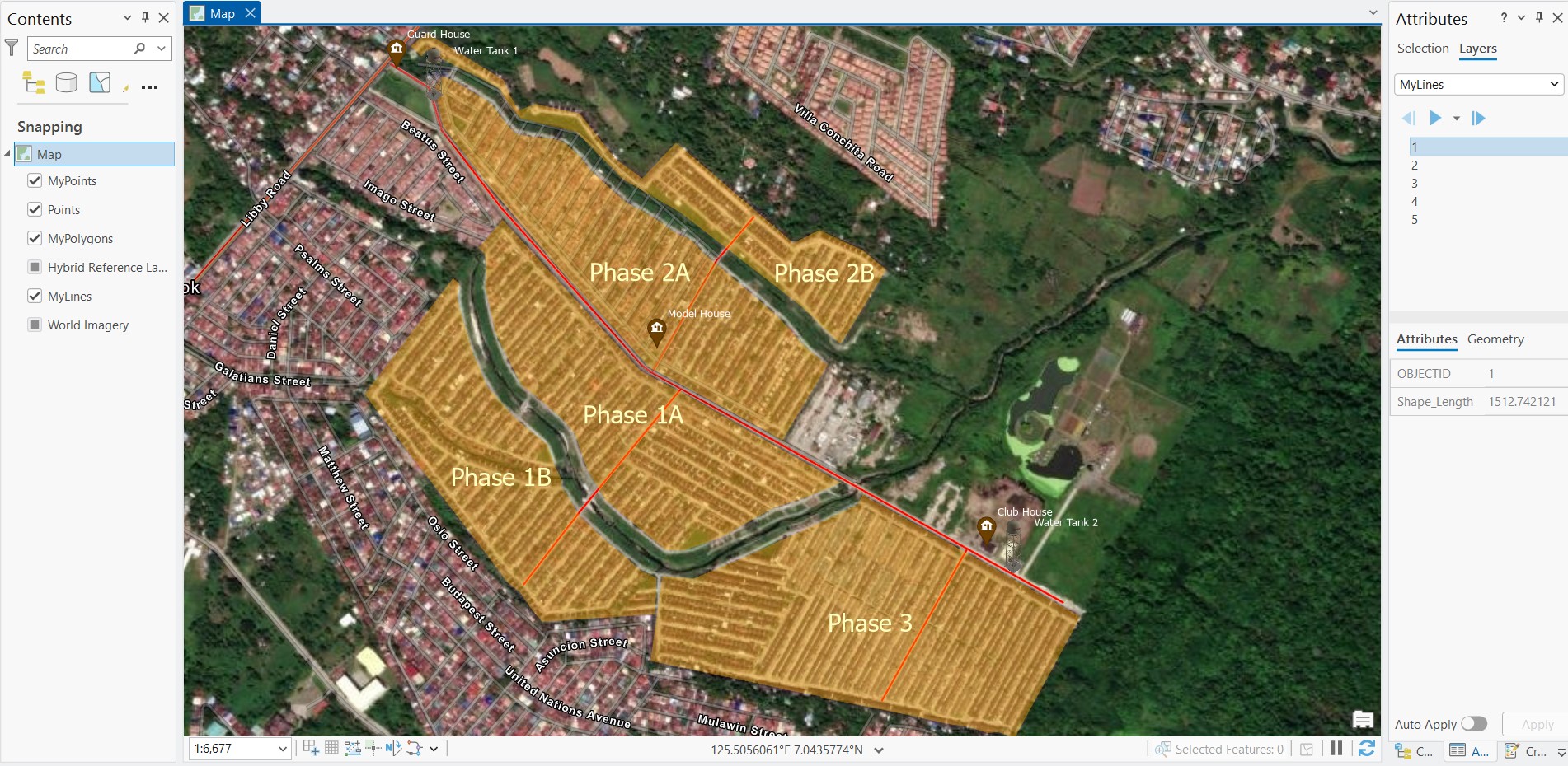
This map displays a digitized layout of a residential subdivision including roads (lines), housing phases(polygons), and key infrastructure points (points) such asguard houses, water tanks, and the model house. The map was created using ArcGlS Pro, overlaid on a satellite basemap for spatial context. Labels were applied to highlight zone names and facilities for better visualization. This project demonstrates basic digitizing and symbology application skills for urban planning and infrastructure mapping